Software

Online Tools for engineers in practice, designed to simplify calculations and enhance productivity in structural design and analysis. All tools are developed with a focus on user-friendly interfaces, accurate results, and compliance with relevant engineering standards.
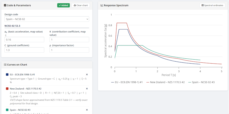
Seismic Spectrum

15 seismic codes
Seismic Spectrum Calculator

Builds the horizontal acceleration response spectrum Sa(T) for 15 seismic design codes worldwide, with overlay comparison of multiple codes / parameter sets on one chart.

  • EC8 Type 1/2, NTC-18, France NA
  • ASCE 7-16/7-22, ASCE 41-17, UBC-1997, NBCC 2015
  • NZS 1170.5, IS 1893:2016, TBEC/TBDY-2018
  • GB 50011-2010, NCSE-02, NTE E.030:2016, Iran 2800
  • Elastic & design spectra · multi-curve overlay

Steel Profile Properties

EC3 · EN 1993-1
Steel Profile Properties

Complete geometric, section and design resistance properties for standard rolled steel sections (IPE, HEA, HEB, HEM) per EC3. Includes cross-section classification and unit switching between cm and mm.
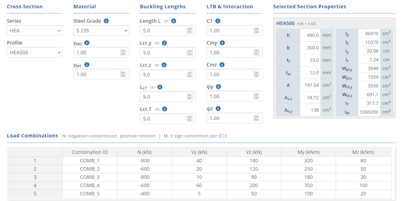
  • Full section geometry & inertia properties
  • Torsional & warping constants
  • Cross-section classification (§5.5)
  • Npl,Rd, Vpl,Rd, Mel,Rd, Mpl,Rd
  • Unit toggle: cm ↔ mm

Steel Member Design

EC3 · EN 1993-1
Steel Member Design

ULS cross-section and member stability checks for standard rolled steel sections (IPE, HEA, HEB, HEM). Supports multiple load combinations with full utilisation factor breakdown.
  • 22 checks per combination (§6.2 & §6.3)
  • Flexural, torsional & LTB buckling
  • Interaction checks (Annex A & B)
  • Section optimizer · CSV export
  • Paste load combinations from Excel

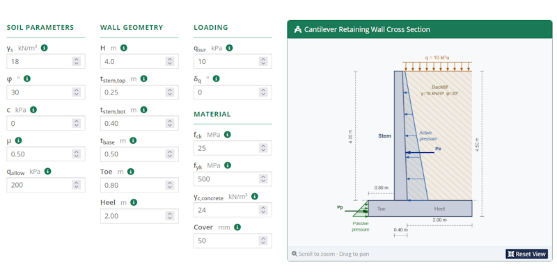
Retaining Wall Design

EC2 · EN 1992-1
Retaining Wall Design

Cantilever retaining wall design using Rankine earth pressure theory. Covers full stability analysis and reinforced concrete structural design with a live dimensioned wall sketch.

  • Rankine Ka / Kp earth pressure
  • Overturning, sliding & bearing checks
  • RC design: stem, heel & toe (EC2)
  • Dynamic cross-section canvas sketch
  • Surcharge & groundwater options

EGSA87 → WGS84

Geodesy · GGRS87
EGSA87 to WGS84 Converter

Converts survey point coordinates from the EGSA87 (GGRS87) projected grid to WGS84 geographic coordinates. Results in decimal degrees and DMS, with an interactive map and spatial statistics.

  • Inverse TM projection & Helmert datum shift
  • Decimal degrees & DMS output
  • Interactive Leaflet map (OSM & satellite)
  • Haversine path length & polygon area
  • Excel import & export · clipboard paste